Google Maps adds disaster alerts following Apple's Maps app debut
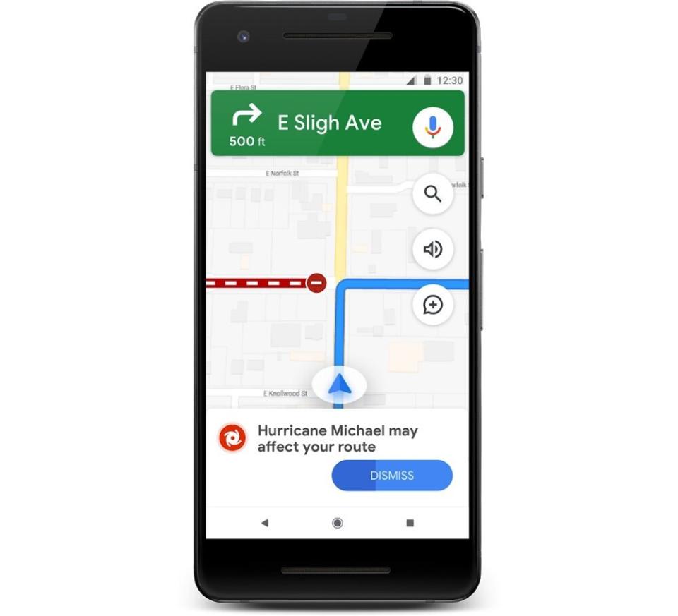
Google (GOOG, GOOGL) Maps is getting a new feature that will help users escape or avoid natural disasters as they unfold. The update, which is part of Google's SOS Alerts, will provide up-to-date information about hurricanes, earthquakes, and flooding.
The update, which comes as the Atlantic hurricane season begins, could help users reach safety in the event of a major storm, or keep them out of a storm's path entirely. It also follows Apple's (AAPL) announcement that the company will be completely revamping its own Maps app as part of its iOS 13 update.
Apple's changes will include a more detailed map and Street View competitor called Look Around, which could draw users away from Google's offering. Adding services like SOS Alerts, though, makes Google's Maps a more versatile app, which might prevent any users from leaving for Apple's app.
Seeing the danger
Google's SOS Alerts already provide users with warning information about disasters, as well as important telephone numbers and updates from local officials. But this new update will automatically give you a special warning card on the Map screen alerting you about the location of an upcoming or recent disaster.
In the case of a hurricane, the feature will provide you with an alert that you can tap on to reveal a detailed look at the storm's potential path of travel. The path mapping will also give you times and dates for when the storm is expected to reach certain regions. All of the information for hurricanes comes from the National Oceanographic and Atmospheric Administration (NOAA), while Japan's hurricane coverage will come from the country’s Japanese Meteorological Agency (JMA).
Earthquakes, which are notoriously difficult to predict, will get a different treatment. Rather than providing a projected range for the earthquake's impact, a Google card will pop up after the quake to give users a sense of how far the shaking was felt.
That radius won't necessarily correspond with damage caused by the quake, but rather its overall magnitude. Earthquake information will come from the United States Geological Survey (USGS).
While hurricane and earthquake information will be available globally, Google says that flooding information will be limited to areas of India for now, as 20% of flooding fatalities come from that region.
Avoiding problem areas
Since you use Maps for, you know, directions, Google is adding alerts that will ensure you don't travel into the line of disaster areas when you're on the road. If your current route puts you into the path of a disaster zone like an area impacted by an earthquake, or where a hurricane is about to make landfall, Maps will send you an alert and divert you around the area.

In addition to helping you avoid disasters, Google's Maps will give you the ability to share your location information with friends and loved ones you want to keep informed as you evacuate a disaster zone. You can also share road closures with other users, and more.
Google's feature is undoubtedly designed to help users in danger, but it will also ensure that they continue to come back to its software. Apple's updates will certainly win over users who have been wary of switching to its own app. But as it builds out the service's feature set, it may need to add features similar to Google's disaster offering going forward.
More from Dan:
What is facial recognition technology and why is it so controversial
The country’s largest transit system will soon let you pay with your iPhone
Email Daniel Howley at [email protected]; follow him on Twitter at @DanielHowley.
Follow Yahoo Finance on Twitter, Facebook, Instagram, Flipboard, SmartNews, LinkedIn,YouTube, and reddit.
